 |
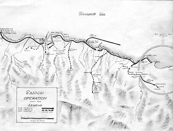
Map of Saidor Operation Sheet No. 2
The map shows the Rai Coast portion of the north coast of New Guinea. Indicated from east to west (right to left) is Saidor, Yamai (Yami), Cape Iris, Mindiri Pt (Mindiri Point), Yalau Pln (Yalau Plantation), Kul 2, Kul 1, Bau Pln (Bau Plantation), Marakum and Bogadjim. The black solid arrow
(our forces) indicates the March 5, 1944 landing of the U.S. Army Yalau Task Force at Yalau Plantation with advances east and west plus advance from Yamai (Yami). The black dotted arrow (our patrols) indicates U.S. Army patrols inland. The white dotted lines indicates Japanese Army (Jap forces) lines or pockets of resistance.
Credit: 13,000 Hours Combat History of the 32nd Infantry Division – World War II Date: March 5, 1944–April 14, 1944
Map
High Resolution Version
Acquire This Image |
Contribute Information
Do you have photos or additional information?
Previous Page
|
|