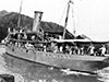
RAN c1915
RAN Sept 10, 1945 |
Location
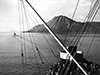
Mount Turangunan (Mt. Turangunan) is located at the eastern tip of the Gazelle Peninsula of New Britain near Rabaul. Known locally simply as "South Daughter".
To the northwest is Mount Kombiu (Mt. Kambiu, Mother) and Rabalanakaia. To the west is Tavurvur (Mt. Tavurvur, Matupi Volcano) and beyond Matupi Harbor and Matupi Island. Borders Praed Point and Saint George's Channel to the east and Blanche Bay to the south. Between 1884–1914 part of Deutsch Neu Guinea (German New Guinea) until September 1914 at the start of World War I. Postwar and during the Pacific War part of the Territory of New Guinea. Today located in East New Britain Province in Papua New Guinea (PNG).
Contribute Information
Do you have photos or additional information to add?
Last Updated
November 22, 2025
|

Map
November 7, 1943 |