5th CCU January 5, 1943 |
Location
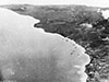
The Gazelle Peninsula is locate at the northeastern tip of New
Britain. Named after the German vessel SMS Gazelle under the command of Georg Gustav Freiherr von Schleinitz. The Gazelle Peninsula includes Rabaul at the northeast tip and borders Simpson Harbor, Karavia Bay and Blanche Bay. At the northeastern tip is Cape Gazelle. Borders St. Georges Channel to the east and beyond New Ireland. Between 1884 until September 1914 part of Deutsch Neu Guinea (German New Guinea). Prewar and during the Pacific War part of the New Britain District in the Territory of New Guinea. Today located in East New Britain Province of Papua New Guinea (PNG).
References
The National "Papua New Guinea Warning on Live Bombs" April 4, 2001
Contribute Information
Do you have photos or additional information to add?
Last Updated
November 22, 2025
|

Map 1912 |